Mount Kumotori “Demon Slayer” Real Life Locations in Japan
Here, I would like to introduce the details about Mt. Kumotori which stands at the boundary of Tokyo, Saitama, and Yamanashi Prefectures.
This is the 7th “Demon Slayer” Real life Locations on the list.
To check out the lists, please click here↓
12 Spots “Demon Slayer” Real life Locations in Japan (Kimetsu no Yaiba)
What Is Mt. Kumotori?
・Location: At the boundary of Tokyo, Saitama, and Yamanashi Prefectures on the island of Honshu, Japan.
・Elevation: 6,618′ (2,017.13m)
Mt. Kumotori is the highest mountain in Tokyo, and this is the only mountain in Tokyo that exceeds 2000m. It was selected as 100 famous mountains in Japan actually.
You can see beautiful Mt. Fuji well from several spots in Mt. Kumotori!
Many mountaineer love this mountain, but climbing this mountain is kind of difficult. Because it is a tough mountain if you are not accustomed to the mountain to some extent, prepare well and climb with experienced people.
#雲取山
— atu1❖BOCCA(海外駐在中)。駐在で貯蓄してモンブランかマッターホルンかアイガーに行く (@atu1standard) November 2, 2020
今回の山行で分かった事
人気の山なので晴れの日は
駐車場争奪戦、テント場争奪戦、
至るところ富士山展望良好
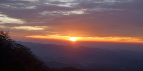
朝日、夕陽の展望良好
山荘のオヤジさんフレンドリー
山荘のテント場サイコー、トイレ水洗
山荘のオヤジさん鬼滅の刃アピール
私、鬼滅の刃無知でオヤジさん撤退
申し訳無い。 pic.twitter.com/uOgiebJPrG
Why Is It Real life Locations?
The reason why Mt. Kumotori has become “real life location” of Demon Slayer is that the main character of Demon Slyer: Tanjiro and his sister Nezuko, their hometown is this mountain.
It is also the main stage of the beginning of the story. After the demon attacks Tanjiro’s family, he is running down the snowy mountain with his sister on his back who was saved alone. That snowy mountain is exactly Mt. Kumotori.
Anime production team actually visited the mountain in order to draw this scene more realistically. The quality of the snowy mountains drawn in the animation is very high, and it became a hot topic that it was wonderful!
東京最高峰の雲取山に登ってきました。11月は紅葉の景色を楽しみながら登山できます。天気も雲ひとつないくらい晴れていて、富士山の眺望も良く、とても心地よい時間でした。
— Aoneko Lab (@blue_cats03) November 7, 2020
雲取山は『鬼滅の刃』炭治郎と禰豆子の出身地とされているため、ファンからは聖地と呼ばれています。https://t.co/BfngS5pP5O pic.twitter.com/nYY91JaUcA
Points to Note When Mountain Climbing
Time
Mt. Kumotori is not an easy mountain to climb. Even experienced climbers can take 6 to 7 hours to reach the summit one way. So, beginners might take 10 hours to reach. Please get ready for a long mountaineering. According to the local guide, it’s better to spend enough time: make a plan and climb a mountain in 2 days and 1 night if possible.
Season
It gets dark earlier during end of fall and winter, and the weather is changeable. The risk of distress definitely increase under the bad weather condition such as wind, rain and snow, and when the temperature difference between day and night is large. Please check the weather forecast in advance very carefully. Probably it’s better to climb from June to October.
Clothes
Some people wear only short sleeve t-shirt and short pants when climbing, but it’s definitely something you should avoid. Don’t wear flip flops either.
It depends on the season, but the lowest temperature may record below zero in November in Okutama-cho, so you should better prepare clothes to keep out the cold. You sweat when you’re climbing a mountain, but the temperature drops after sunset and as the altitude rises. You may want to bring spare clothes to protect against the cold
Please don’t forget to bring extra water and snacks too just in case!
Basic Information of Mt. Kumotori
Mount Kumotori 雲取山
・Address: Ohtaki, Okutama town, Nishitama-gun, Tokyo, Japan
・Tel: 0494-55-0861
Transport / Access to Mt. Kumotori
The nearest station is Okutama station on JR Ohme line.
How to get to the starting point of a trail up a mountain called Kamosawa-tozanguchi (鴨沢登山口) from Okutama station↓
・Bus: Please take the Nishi Tokyo Bus bound for [Kamosawa-nishi (鴨沢西) or Tanba (丹波)] departs from [Okutama station on JR Ohme line]. It takes about 35 minutes to get the starting point, and costs 630 yen.
・Taxi: Taxi is not always stopped, so you should probably reserve a taxi in advance. It takes about 30 minutes to get the starting point.
LEGALCAB Taxi Tel: 042-550-2712
If you use car to get there, there are parking lot in several places.
・Tozura (留浦) free parking lot near Okutama station (having almost 25 parking spaces)
・Free parking lot near Kamosawa (鴨沢) bus stop along National Route 411 (having almost 13 parking spaces)
・Kosodenokkoshi (小袖乗越) parking lot (having almost 60 parking spaces)
鬼滅の聖地、雲取山は鴨沢ルートの標準タイムで往復10時間ぐらいです。
— マチロウ (@machidamachiro) November 5, 2020
難しい山じゃないですが、それなりに準備したほうがいいと思います。 pic.twitter.com/zWlZNgbIV8
↑The starting point of a trail up a mountain, Kamosawa-tozanguchi (かもさわ登山口)

